Paving the way for safer streets with tactical urbanism
The project focussed on improving pedestrian safety and traffic flow at a busy intersection of Undri using the tactical urbanism method. I worked on this urban design project at StudioPOD, by collaborating with SaveLIFE Foundation.
What does StudioPOD do?
StudioPOD is an award-winning urban design and planning studio. The projects are of varying scales that include strategic and regional plans, transportation and campus plans, landscape urbanism, placemaking and streetscapes.
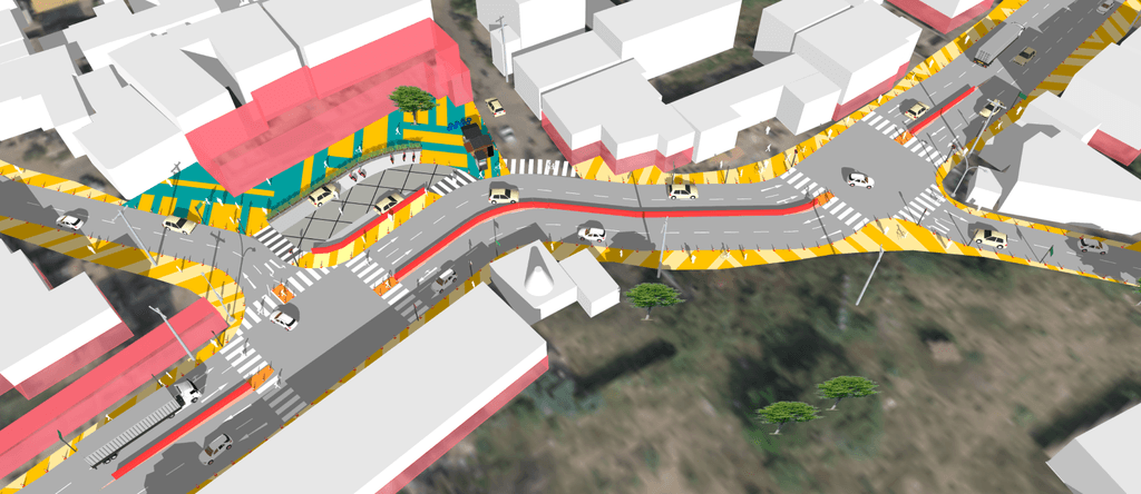
SketchUp view of proposed design
Role
Architect
Collaborators
SafeLIFE Foundation
Project size
6,194 sq.m
Year
2022
Overview
Some Indian roads have mixed vehicle types, including cars, motorcycles, rickshaws, trucks, and pedestrians, all navigating together. Due to the lack of organization, the intersections pose a threat to pedestrians and vehicles—Undri was one such intersection.
What is tactical urbanism?
It is a method to implement and test design solutions quickly, innovatively, and cheaply (e.g., marking the designs with vibrant paints, marking the areas with potted plants/benches, etc.). Often, it is an initiative by the people for the people.
The challenge
The Undri junction was a bustling intersection at the center of a neighborhood, posing significant safety concerns. Vehicles frequently exceeded the speed limits, resulting in multiple accidents and near-misses.
Such an intersection caused difficulties for pedestrians to walk or cross the road, putting them at high risk. The intersection had a lot of commercial activities like small vendors, shops, hospitals, and temples, which added another level of complexity to the project.
Design approach
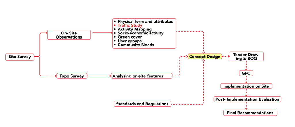
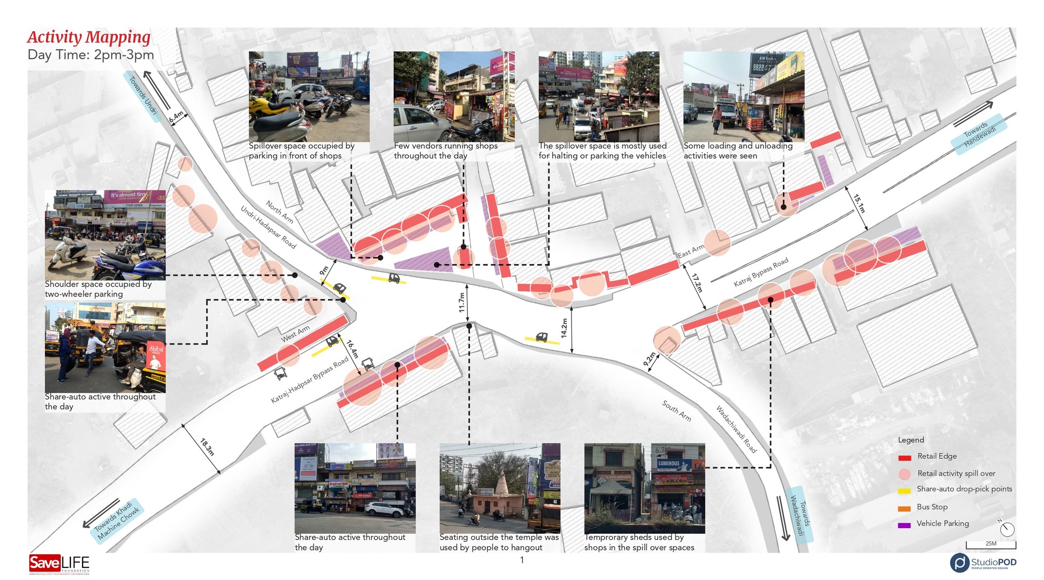
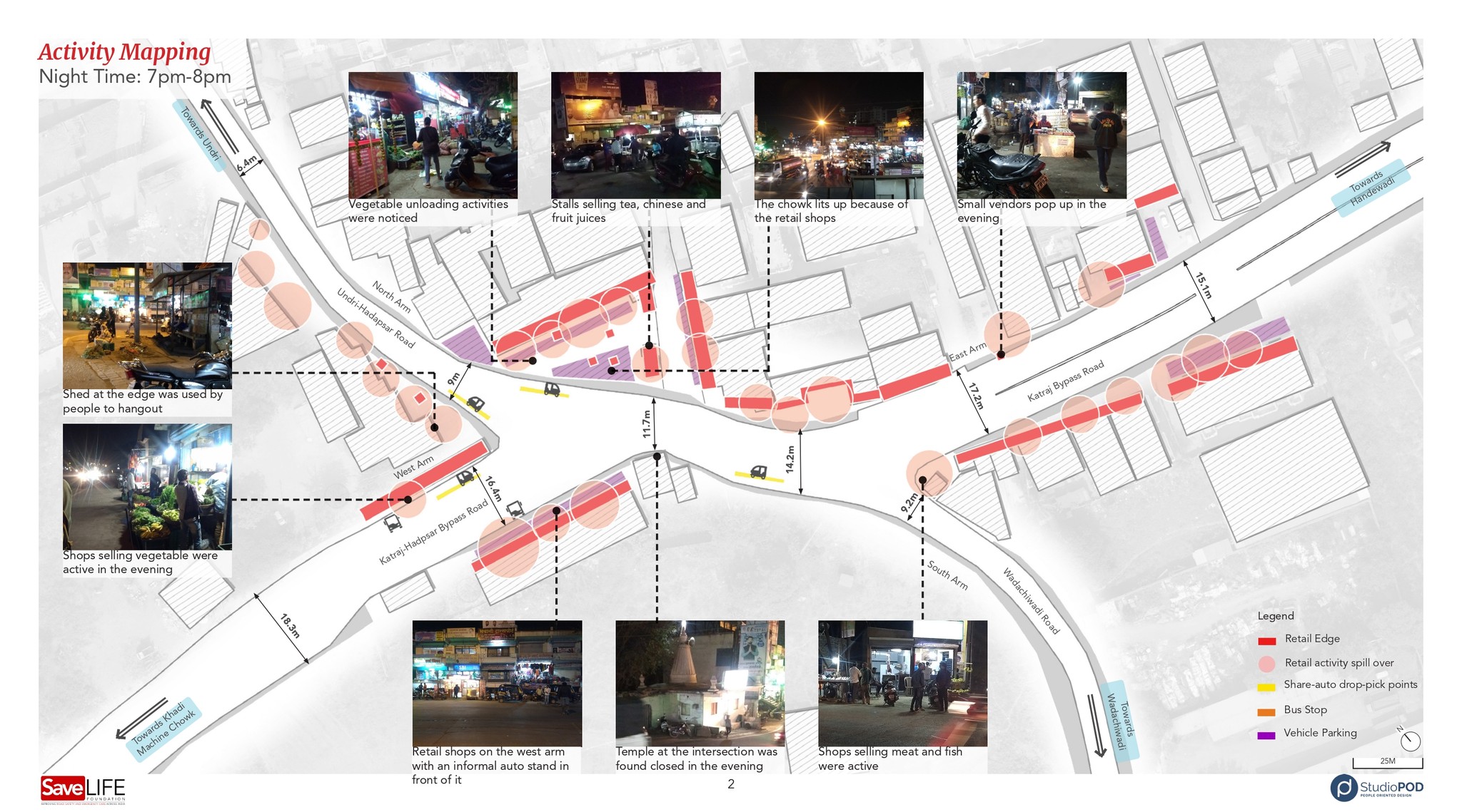
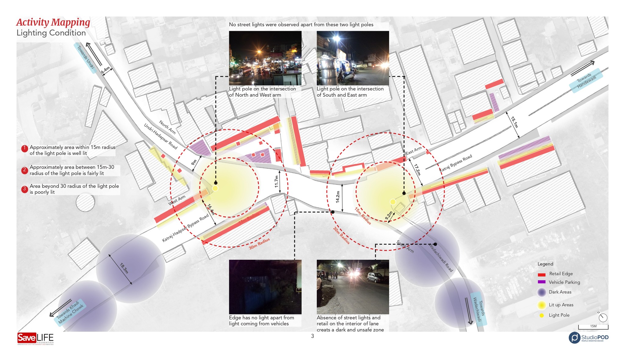
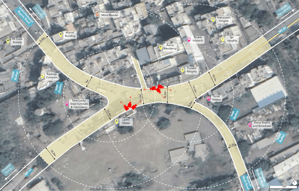
This project was based on research at various levels. We visited the site multiple times to understand the nature of the intersection, vehicular patterns, activities during the day and night, and commercial and residential areas.
We installed cameras to collect data of the vehicles and pedestrians for a period of three days.
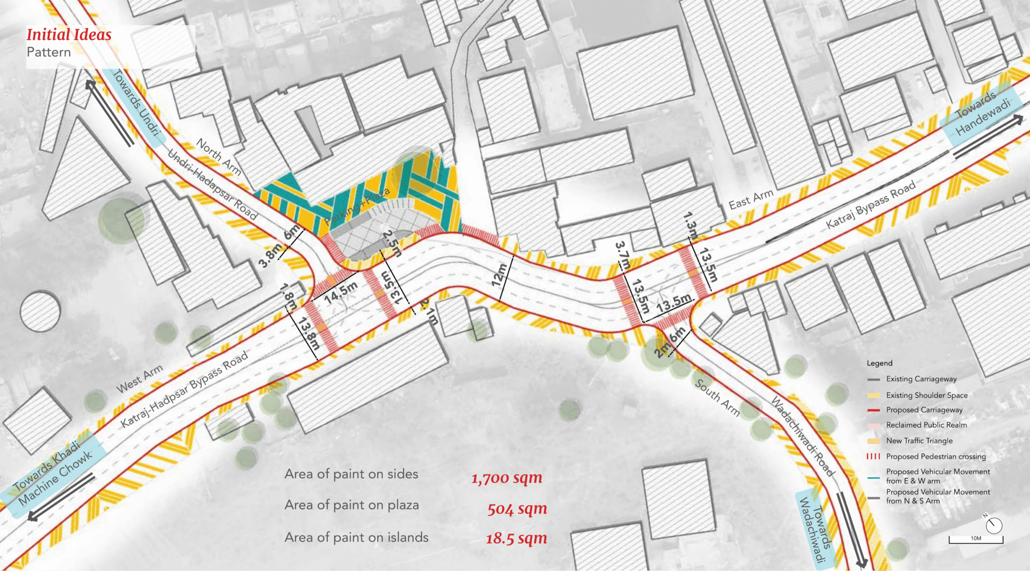
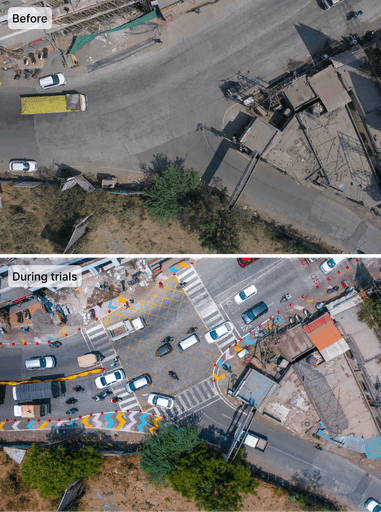
Considering the local norms and standards, we proposed and implemented our designs as tactical urbanism on-site for seven days.
We again collected the data during the trials and concluded with the observations, proposing future developments.
Getting to know the site
Activity mapping
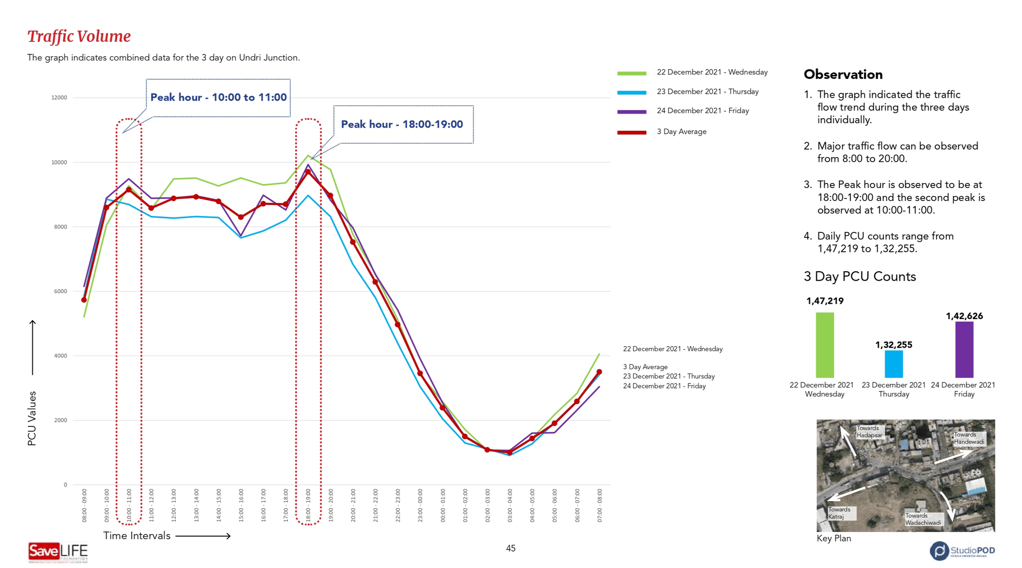
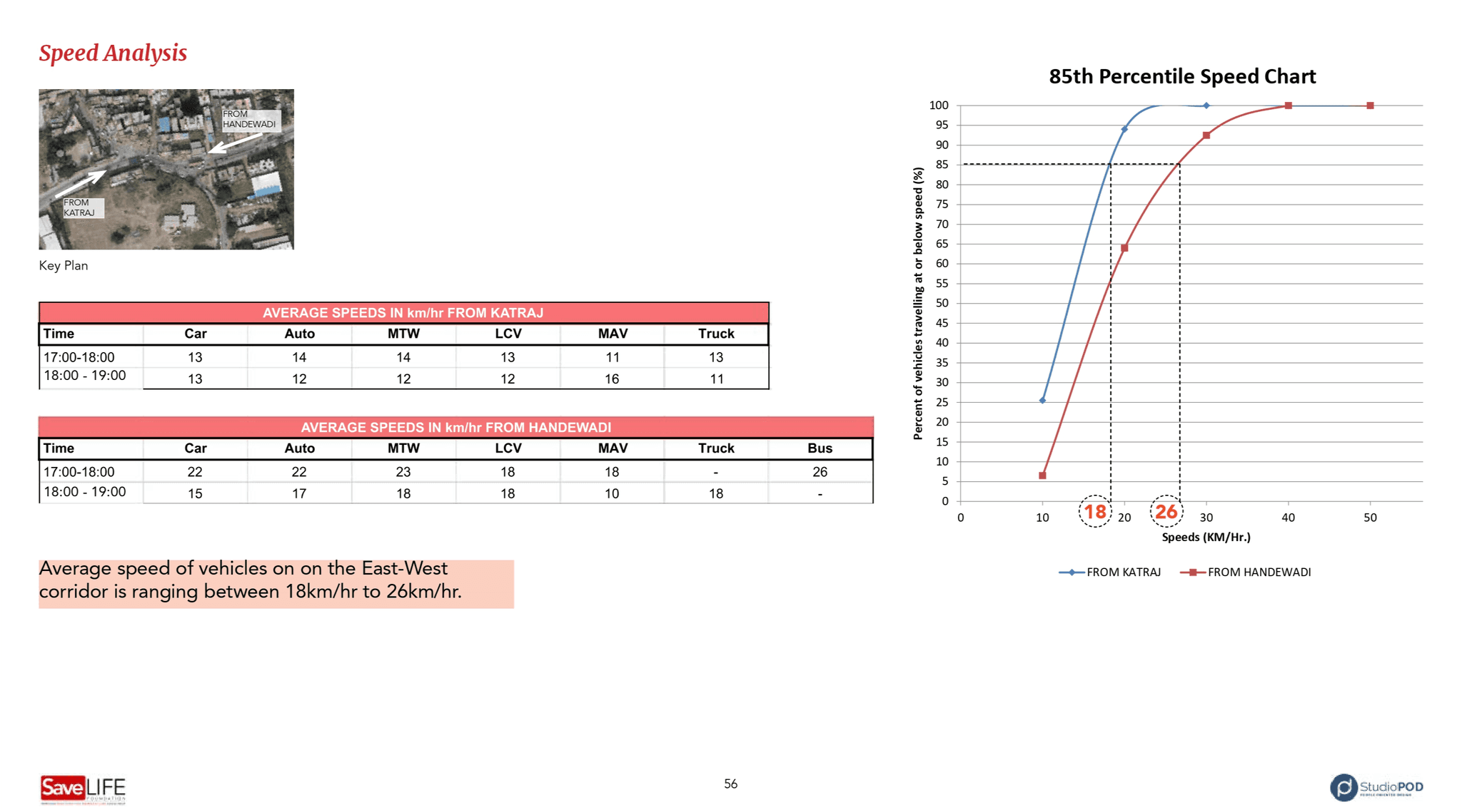
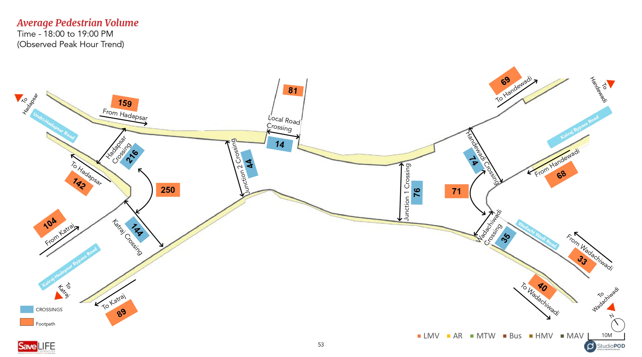
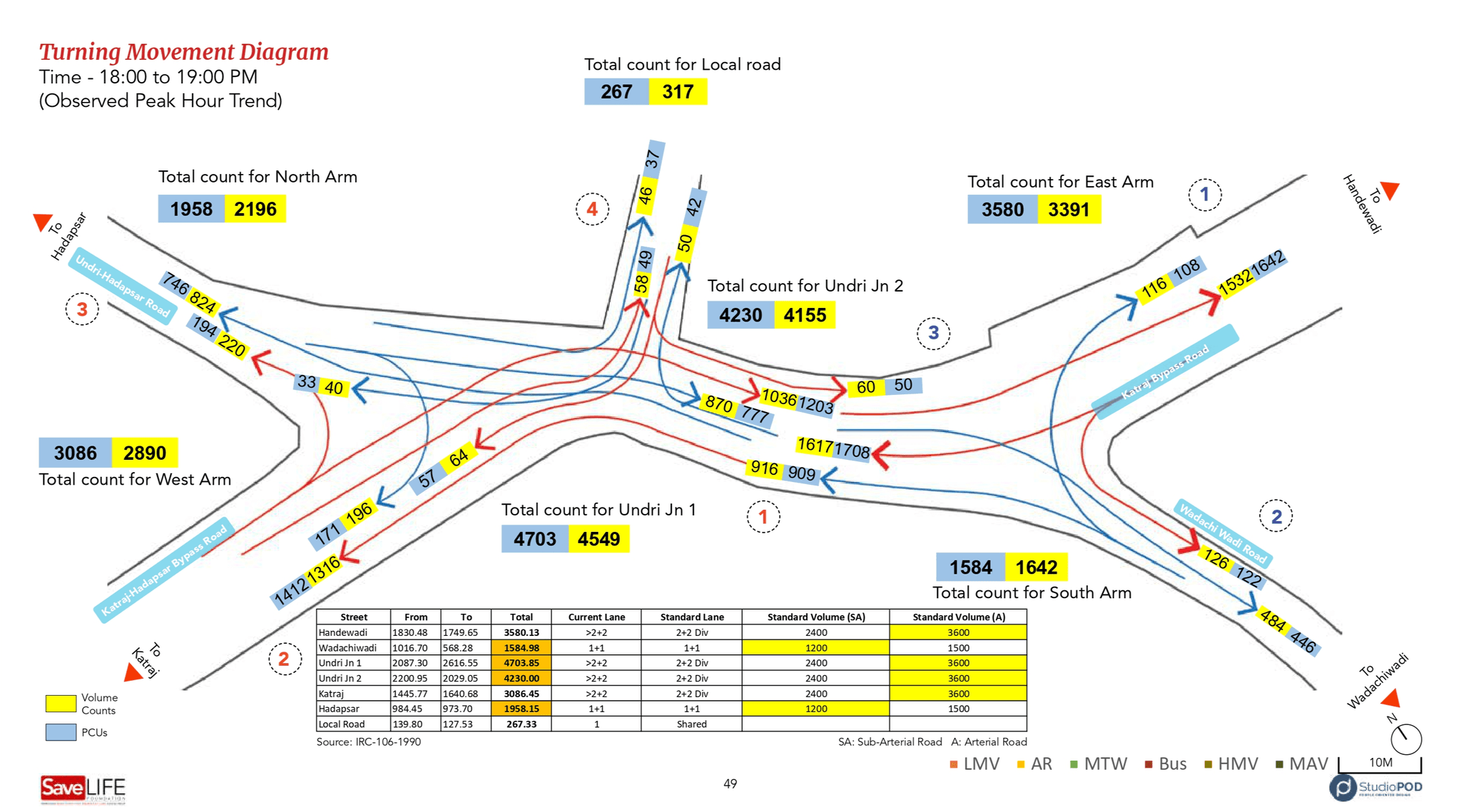
Traffic data analysis
Cameras were installed on site to collect the data of 3 days. The data included-
1. Traffic volume- Number of vehicles passing through each side. (Vehicles were categorised in 12 vehicle class)
2. Percentage of each vehicle class in the traffic volume.
3. Count of vehicles flowing into each arm
4. Count of vehicles taking a U-turn
5. Count of pedestrians passing through each side
6. Count of pedestrians crossing the road
7. Speed of the vehicles
Conclusions
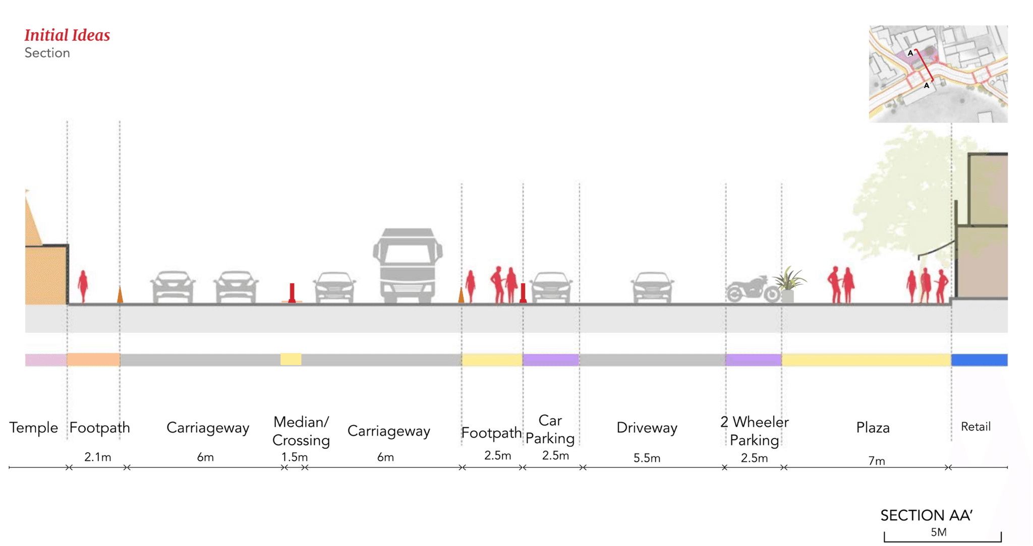
The site lacked safe and functional pedestrian infrastructure, with no usable footpaths or crossings to ensure secure pedestrian movement. A minimum clear width of 1.8 meters for footpaths was recommended.
Streamlining traffic flow at the intersection was essential to alleviate congestion and reduce conflicts between vehicles and pedestrians.
Given the context, the deployment of traffic wardens were necessary. Although highways in India typically lack traffic signals, the high traffic volume at this intersection necessitated active monitoring measures.
The informal open space near the intersection required formalization, including designated parking areas to improve organization and functionality.
Goals
After conducting thorough research, we refined the project goals and vision to focus on:
Designating clear, organized spaces for vendors to ensure accessibility while reducing encroachment on pedestrian and vehicular zones.
Creating safe, well-defined sidewalks for pedestrians by enhancing walkability and minimizing conflicts with other modes of transport.
Facilitating efficient and smooth traffic flow through optimized lane management and better traffic calming measures.
Concept design
Through multiple site visits, observations, interviews, and data collection, we developed several design iterations to address the challenges at the intersection.
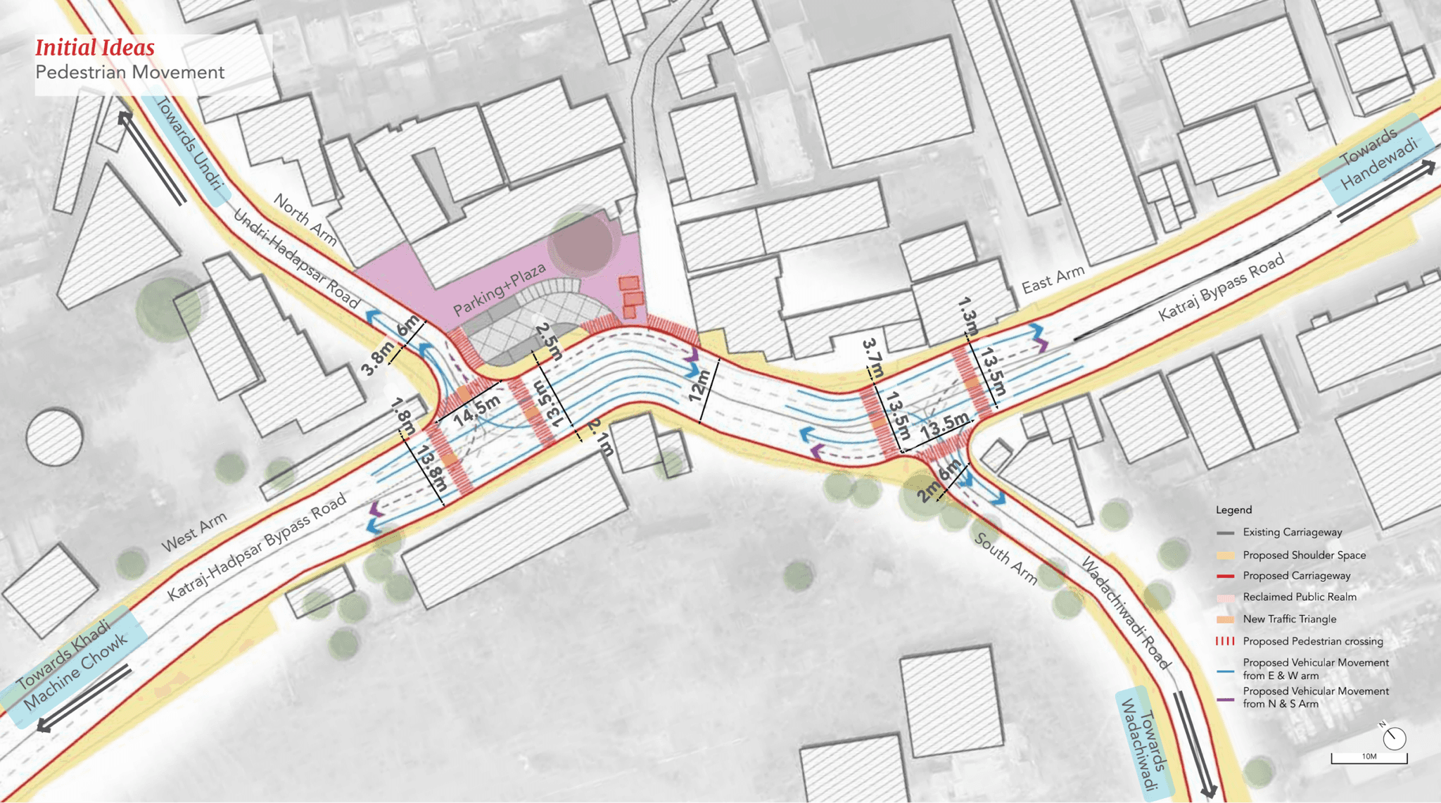
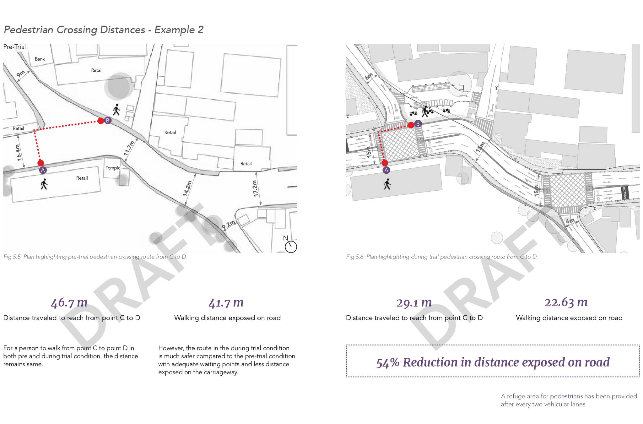
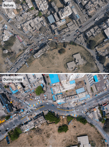
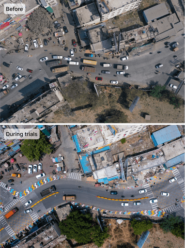
We began by redrawing the right-of-way and dividing the large intersection into two manageable intersections, which helped streamline vehicle movement and improve traffic control. This separation also enabled the introduction of safer pedestrian crossings.
By reorganizing the intersection, we aimed to slow down traffic and encourage more cautious driving behavior. The design retained the same number of lanes on all arms with an optimized turning radius for better maneuverability.
Vehicular movement and conflict points
Vehicular movement and conflict points
Vehicular movement and conflict points
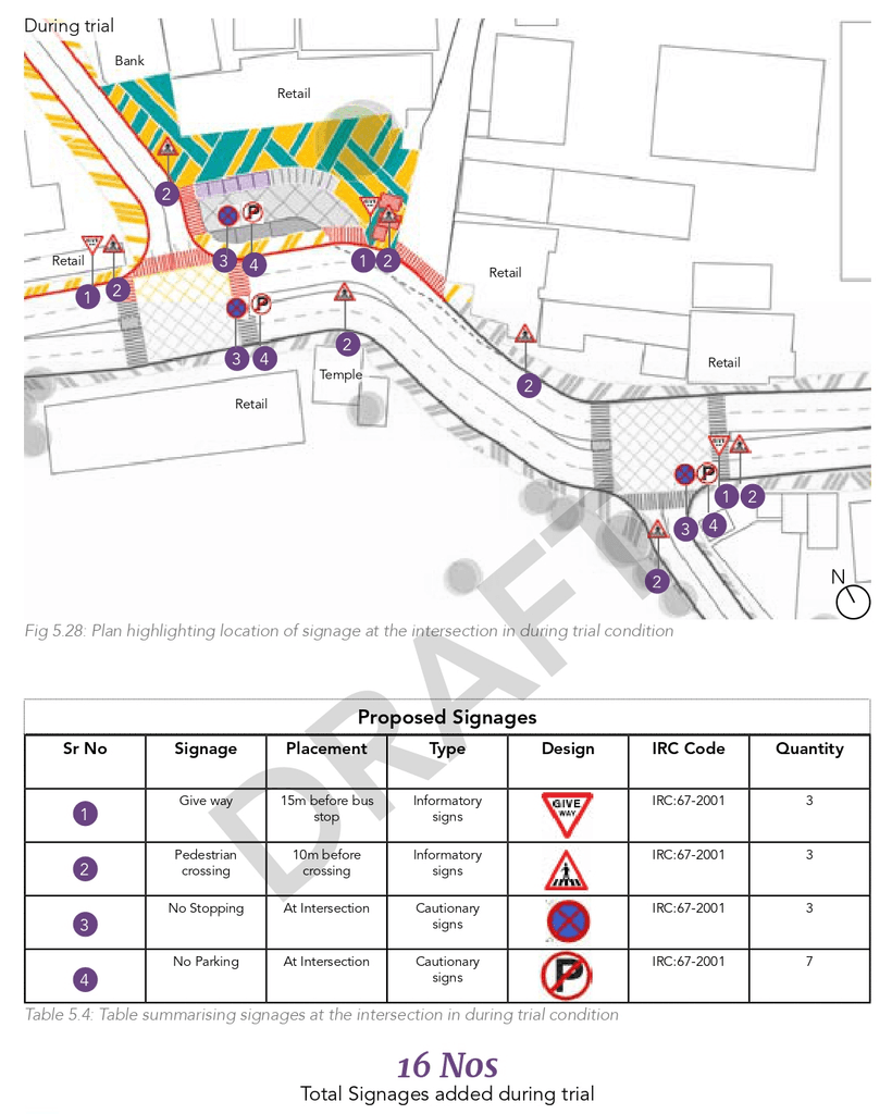
The final designs incorporated a more clearly defined layout of the intersection and pedestrian crossings to improve functionality and safety. Additionally, we proposed installing appropriate signage to guide both vehicular and pedestrian traffic effectively, ensuring better navigation and reducing potential conflicts in the area.
What we achieved
Enhanced Pedestrian Safety
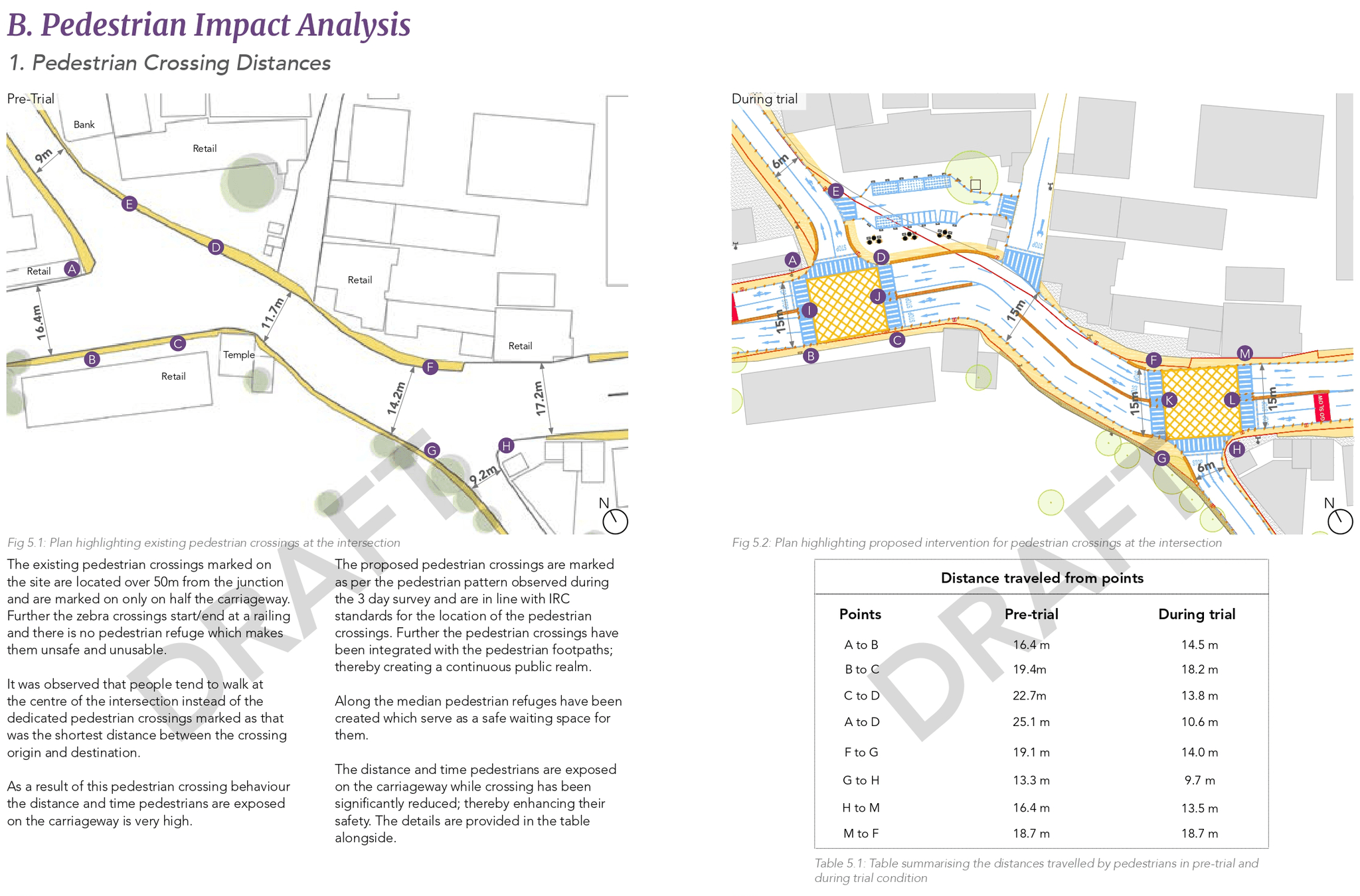
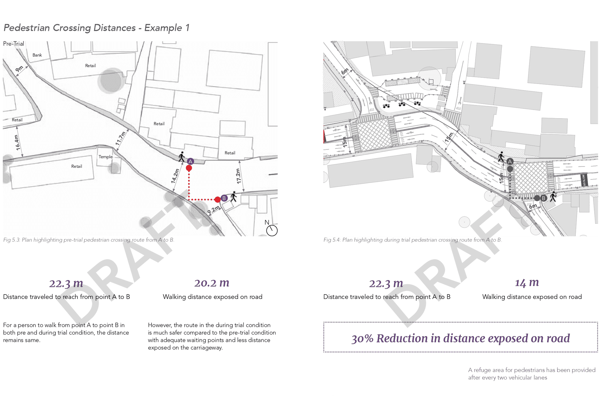
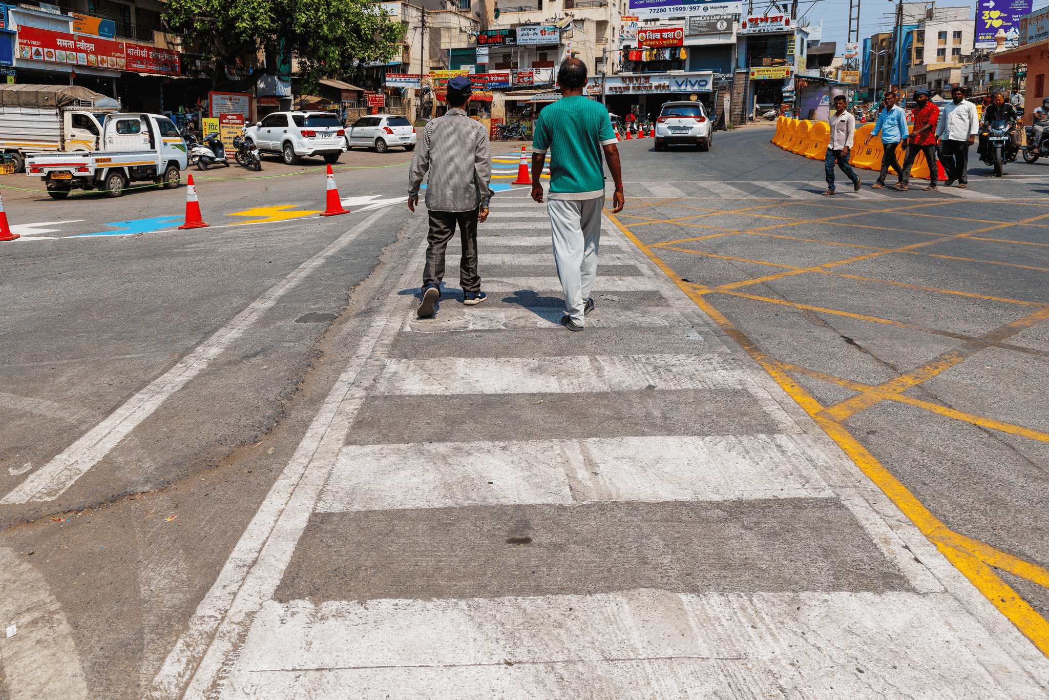
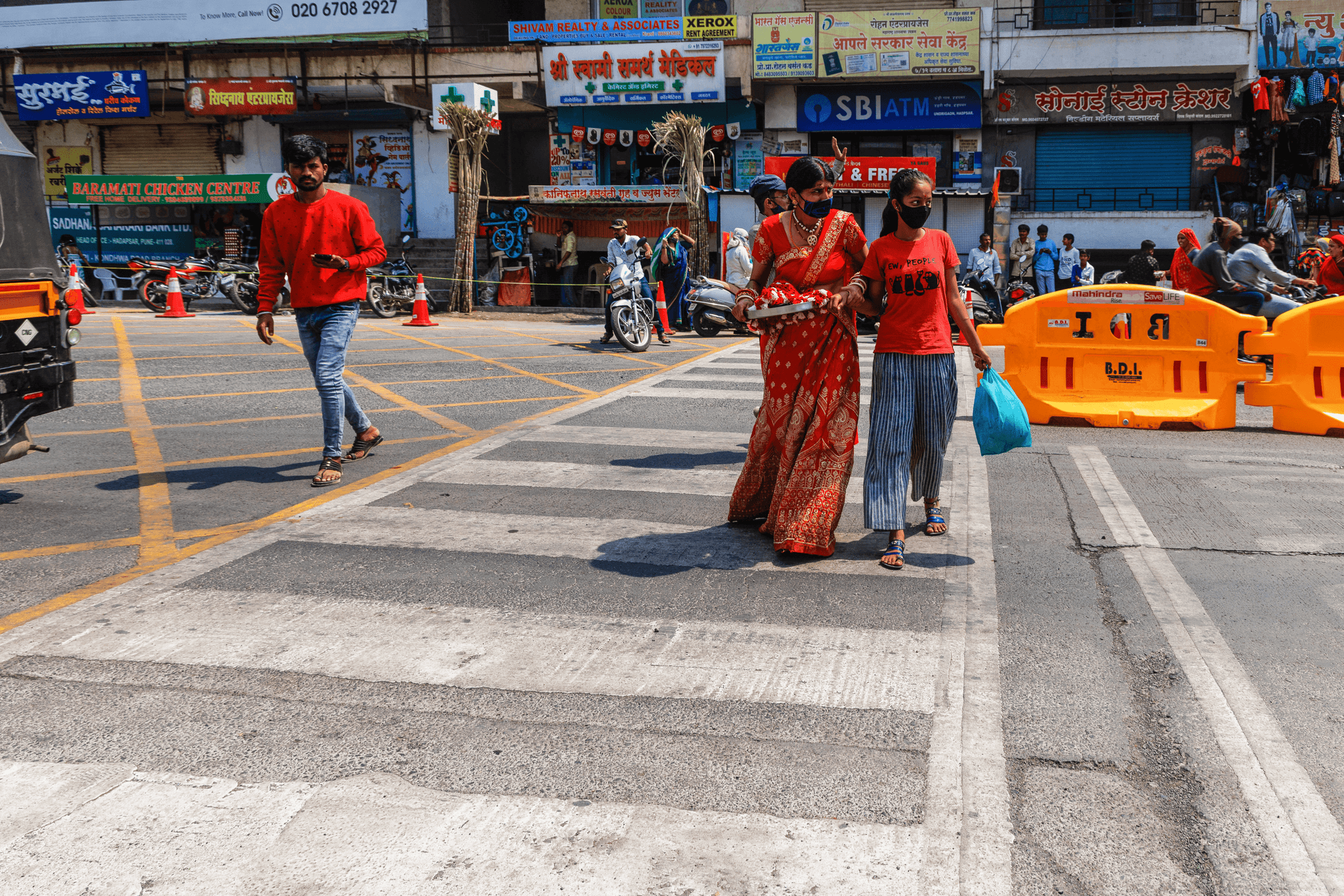
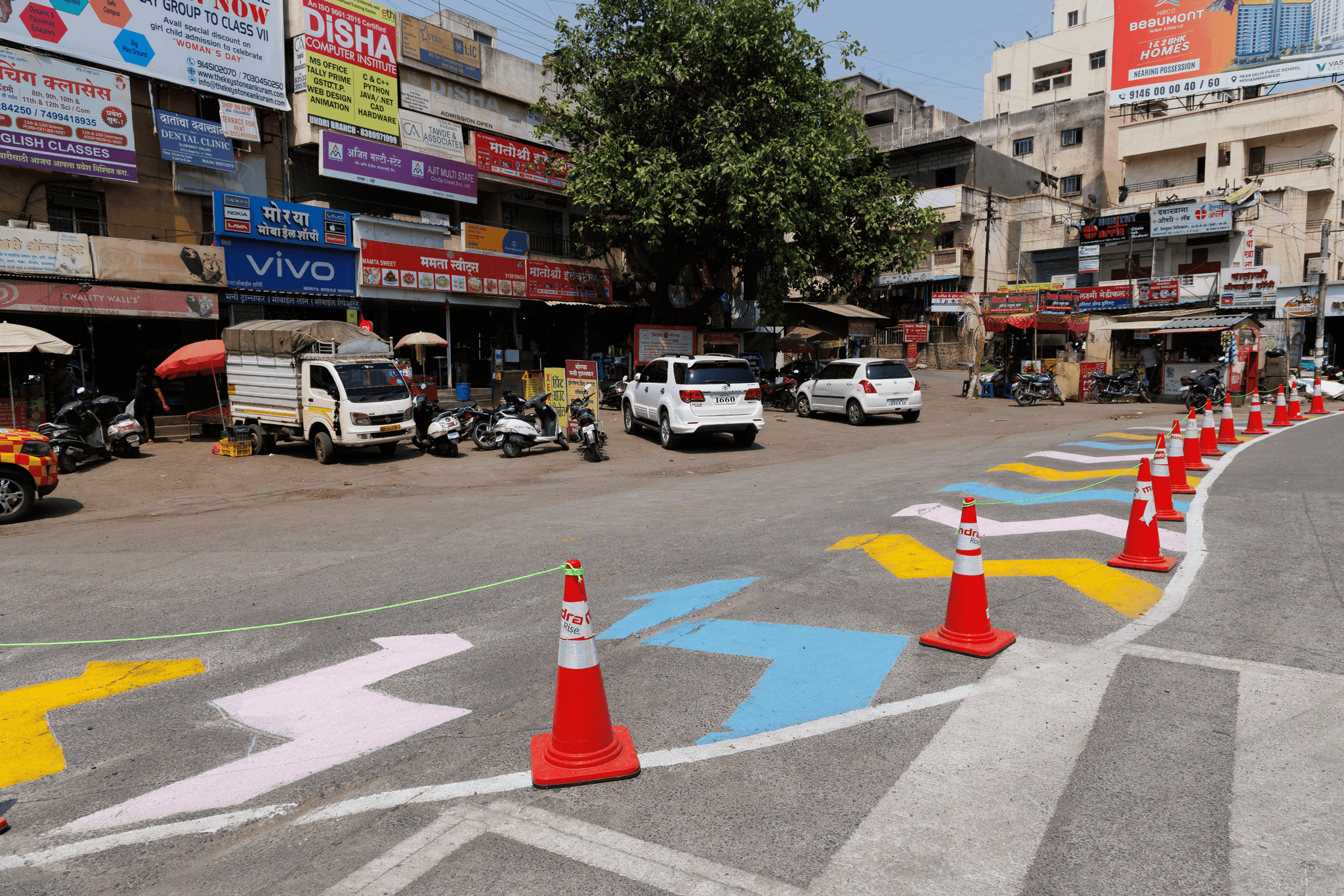
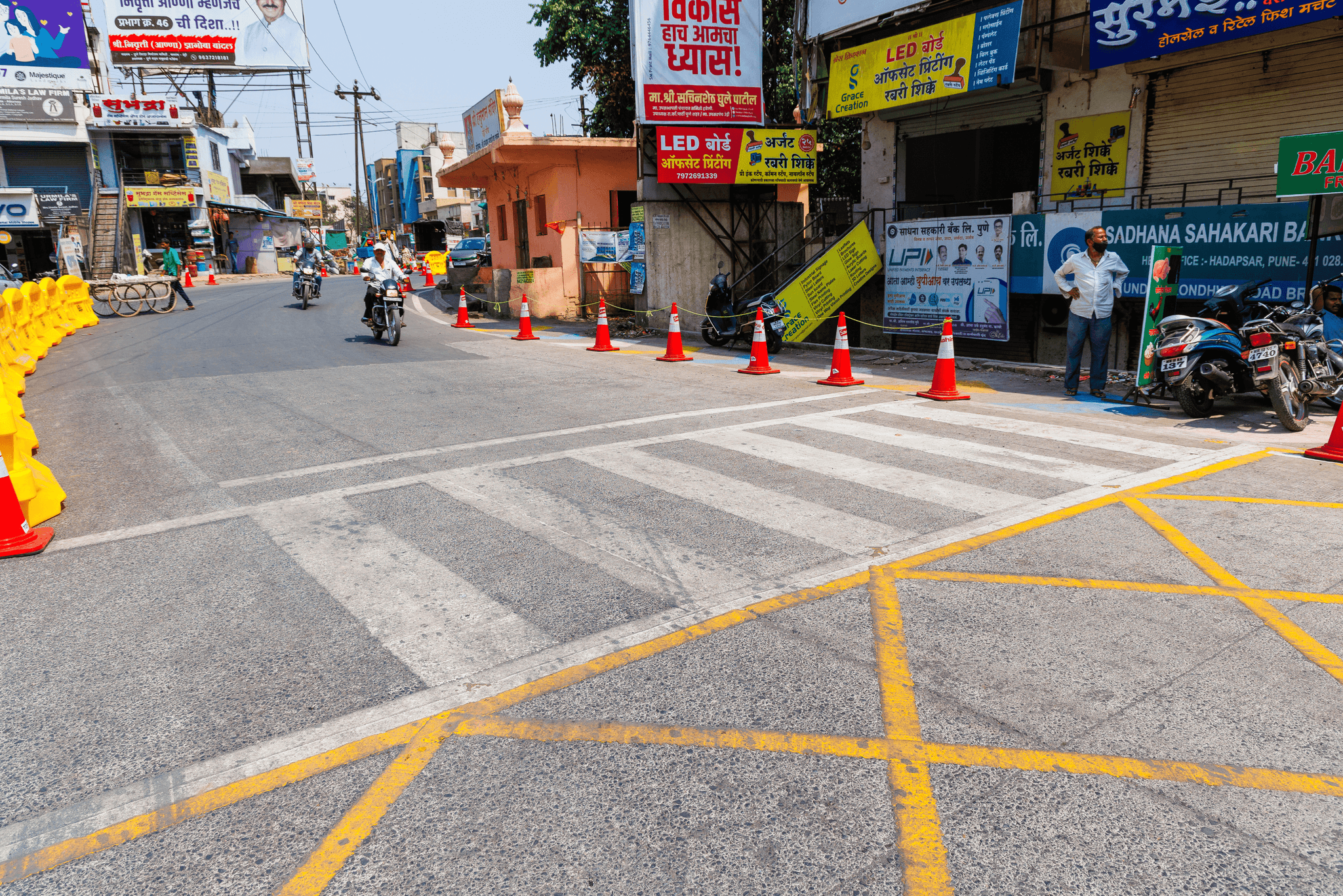
We successfully created safer pedestrian crossings and reclaimed 1,533 square meters of space for sidewalks. This provided pedestrians with dedicated areas to walk and cross, significantly reducing their exposure to moving traffic.
Reduced Vehicle Speeds
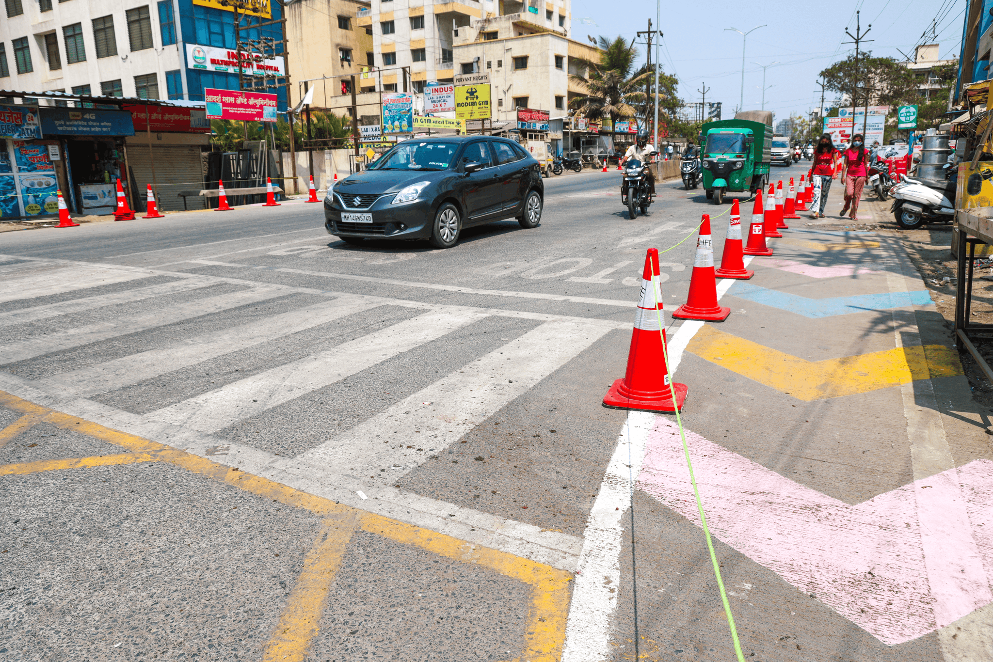
We slowed down vehicular traffic by reconfiguring the intersection and dividing it into two parts. The more organized layout and optimized turning radii encouraged drivers to navigate the junction more carefully, minimizing the risk of accidents and conflicts.
Pilot for Long-Term Solutions
The temporary intervention was a pilot, demonstrating how tactical urbanism can lead to effective, scalable solutions. The project's success provided valuable insights for potential long-term, permanent changes to further improve safety and functionality at the intersection, which was proposed to the government authority.
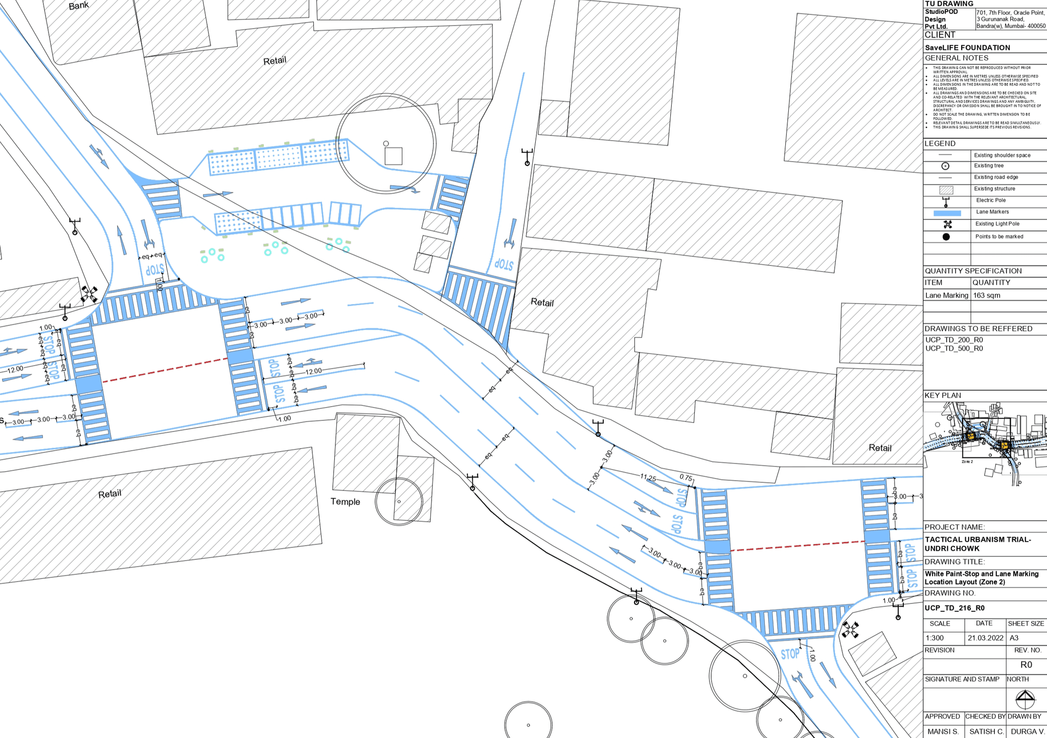
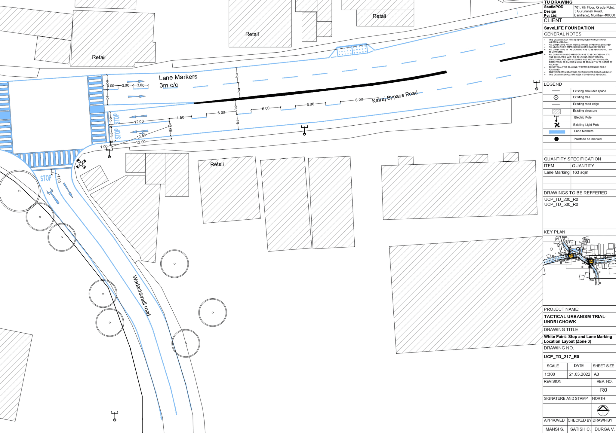
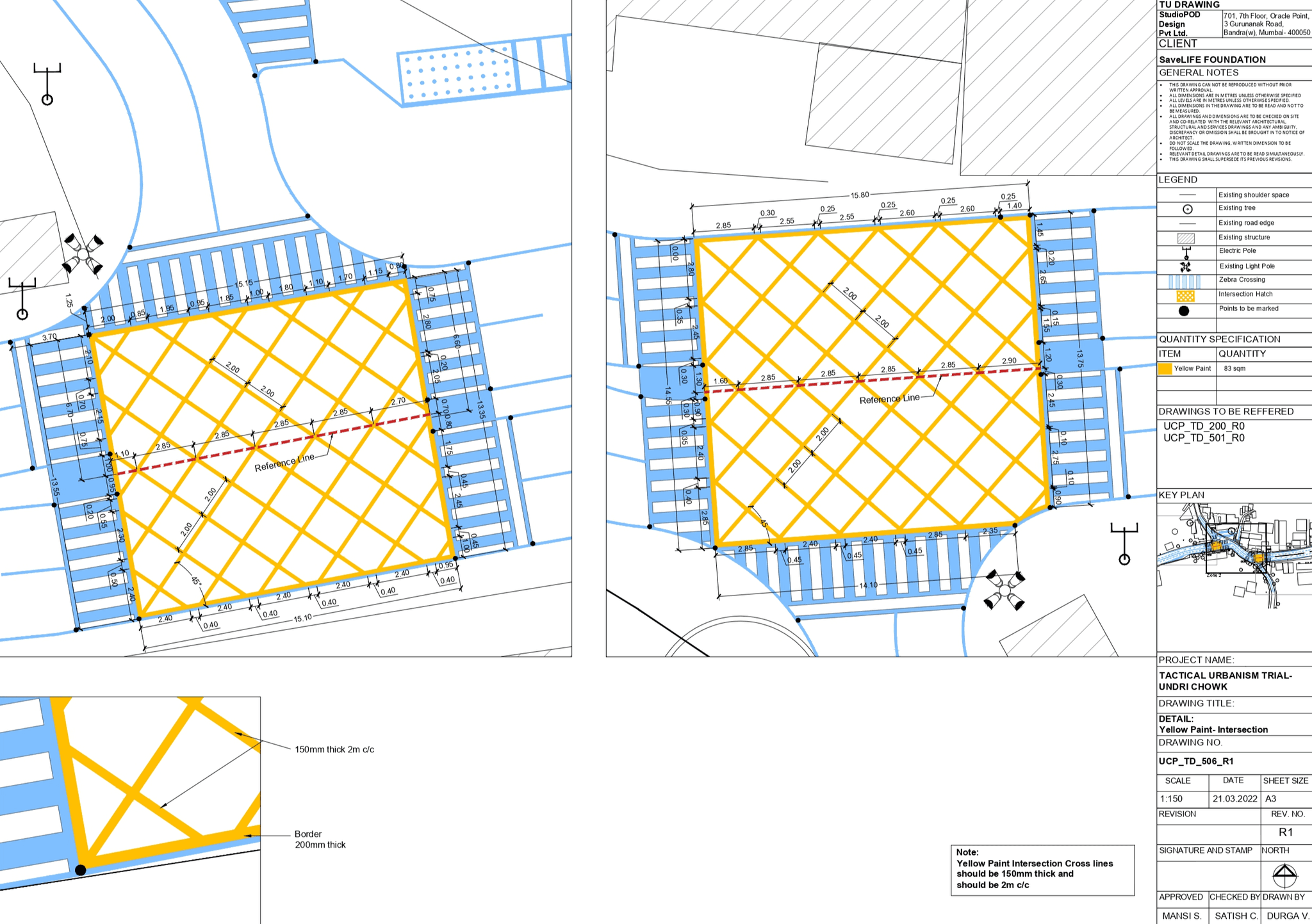
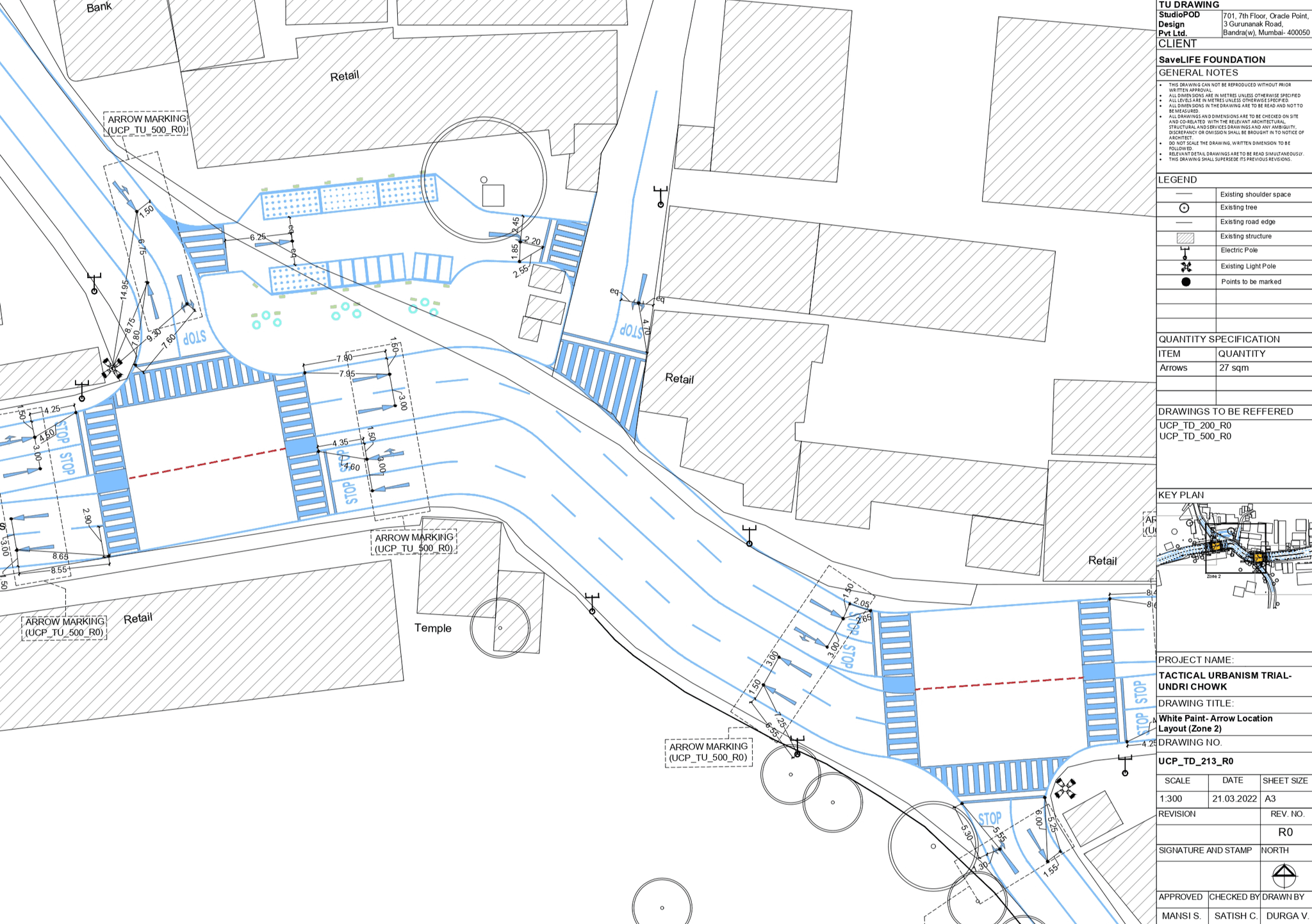
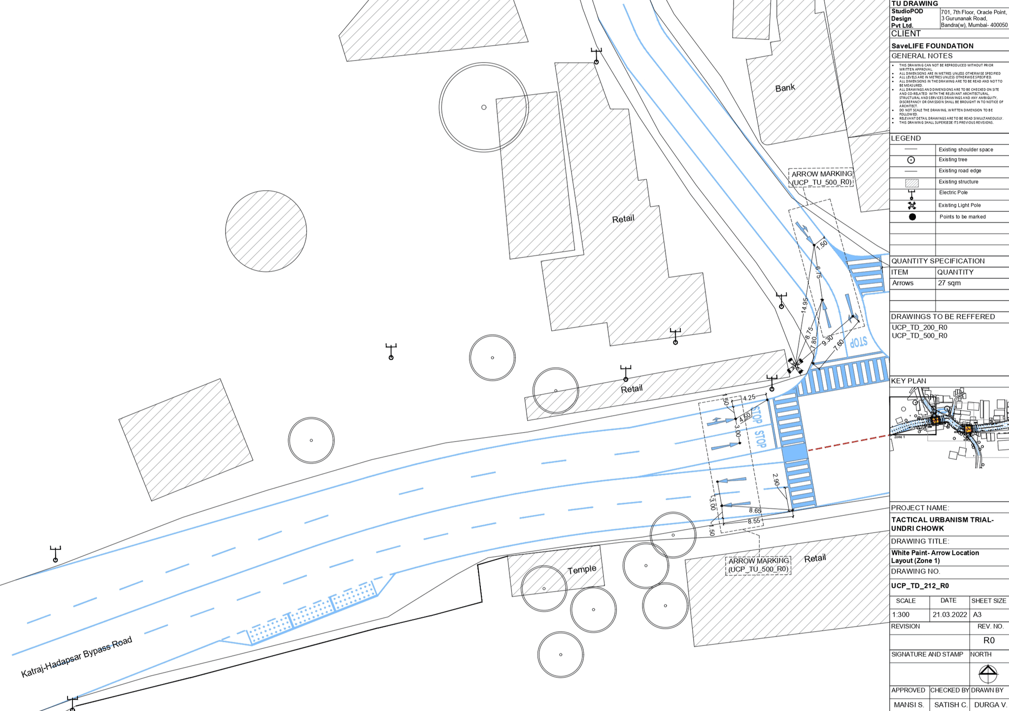
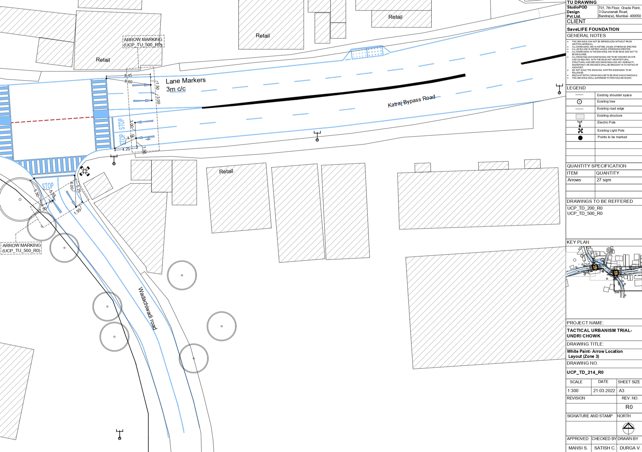
Set of drawings to mark designs on site
We compiled a well-drafted, detailed, and comprehensive set of 34 drawings for the site. A triangulation technique was used to mark the design on site. I also supervised the on-site work of marking the right-of-ways and the crossings. Here are a few of the drawings-
Key takeaways-
I learned the significance of using data to inform design decisions. Analyzing vehicular and pedestrian patterns revealed the intersection’s weak points and helped us craft a solution grounded in reality rather than assumptions.
I gained valuable insights into the potential of tactical urbanism to test and refine solutions before implementing permanent changes. It showed me how small, inexpensive interventions could significantly impact urban spaces and lead to lasting improvements.
I learned how essential collaboration with stakeholders, including local authorities, traffic wardens, and community members, is for successful urban interventions. This teamwork approach ensured that the solutions were practical, implementable, and met the needs of everyone affected by the junction's redesign.
